
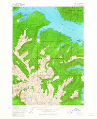
1951 Map of Sitka B-4
USGS Topo · Published 1956About this map
Peril Strait separates the northern reaches of Baranof Island from Chichagof Island, a region defined by maritime navigation and steep topography in the mid-1950s. The coastline is punctuated by several significant inlets including Rodman Bay, Appleton Cove, and Saook Bay, which provided sheltered waters for early transit and industry. A small collection of cabins and a shelter cabin near Lake Eva indicate the sparse human footprint in this wilderness area, while the McClellan Rk Light and Lindenberg Harbor mark critical points for vessels maneuvering through the strait. Further inland, the map captures the high-elevation relief of the Moore Mountains and prominent peaks like Annahootz Mountain and Mt Rosenberg. The drainage patterns are clearly visible, with the Clear River and Rodman Creek feeding into the intricate system of arms and flats that characterize the Alaskan panhandle.
Find a feature on this map
33 named features on this map. Tap any name to fly to it.
Don’t see what you’re looking for? This feature index may not catch every label — zoom into the map to look around manually.
Map Details
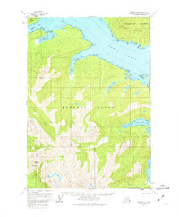
Editions of this 1951 Sitka B-4 Map
3 editions found
Other maps of this area

1948 · Sitka B-3
USGS Topo · 1:63,360

1948 · Sitka A-5
USGS Topo · 1:63,360

1948 · Sitka A-3
USGS Topo · 1:63,360

1948 · Sitka C-3
USGS Topo · 1:63,360

1948 · Sitka B-5
USGS Topo · 1:63,360

1951 · Sitka C-5
USGS Topo · 1:63,360

1951 · Sitka C-4
USGS Topo · 1:63,360

1951 · Sitka B-5
USGS Topo · 1:63,360

1951 · Sitka
USGS Topo · 1:250,000

1951 · Sitka A-4
USGS Topo · 1:63,360