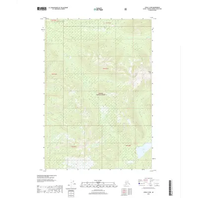
2017 Map of Sitka C-2 NW
USGS Topo · Published 2017About this map
Tongass National Forest dominates this coastal Alaskan landscape, revealing a wild and intricate topography defined by steep elevations and glacial watersheds. The map highlights the rugged interior of Admiralty Island, where Thayer Peak stands as a prominent landmark overlooking the high country. Drainage patterns are clearly defined by the flow of Fishery Cr in the north and the southern reach of Thayer Cr, which outlets from the expansive Thayer Lake. This 2017 survey serves as a precise record of the roadless wilderness within the Unorganized Borough, capturing the untouched character of the forest's interior before modern development or intensive infrastructure could reach these remote sections of the Alexander Archipelago.
Find a feature on this map
11 named features on this map. Tap any name to fly to it.
Don’t see what you’re looking for? This feature index may not catch every label — zoom into the map to look around manually.
Map Details
Editions of this 2017 Sitka C-2 NW Map
This is the sole edition of this map. No revisions or reprints were ever made.
Other maps of this area

1948 · Sitka C-2
USGS Topo · 1:63,360

1948 · Sitka C-3
USGS Topo · 1:63,360

1948 · Sitka D-3
USGS Topo · 1:63,360

1948 · Sitka D-2
USGS Topo · 1:63,360

1951 · Sitka
USGS Topo · 1:250,000

1951 · Sitka D-3
USGS Topo · 1:63,360

1951 · Sitka C-3
USGS Topo · 1:63,360

1951 · Sitka D-2
USGS Topo · 1:63,360

1951 · Sitka C-2
USGS Topo · 1:63,360

1952 · Sitka
USGS Topo · 1:250,000