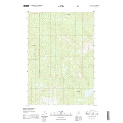
2021 Map of Sitka C-2 NW
USGS Topo · Published 2021About this map
Tongass National Forest dominates this topographic study of the Admiralty Island wilderness, capturing a landscape of steep ridgelines and isolated water bodies. The terrain is anchored by the prominent Thayer Peak, which rises above a network of drainages and glacial valleys. Toward the north, Fishery Cr winds through the interior, while the southern reaches of the map are defined by the presence of Thayer Lake and its outlet, Thayer Cr. This 2021 survey utilizes high-resolution data to delineate the intricate contours and wetland patterns typical of this coastal rainforest environment. The map provides a detailed view of the township and range divisions, such as t48s r67e, which overlay this largely roadless territory, reflecting the structured management of one of the nation's most extensive protected forest areas.
Find a feature on this map
11 named features on this map. Tap any name to fly to it.
Don’t see what you’re looking for? This feature index may not catch every label — zoom into the map to look around manually.
Map Details
Editions of this 2021 Sitka C-2 NW Map
This is the sole edition of this map. No revisions or reprints were ever made.
Other maps of this area

1948 · Sitka C-2
USGS Topo · 1:63,360

1948 · Sitka C-3
USGS Topo · 1:63,360

1948 · Sitka D-3
USGS Topo · 1:63,360

1948 · Sitka D-2
USGS Topo · 1:63,360

1951 · Sitka
USGS Topo · 1:250,000

1951 · Sitka D-3
USGS Topo · 1:63,360

1951 · Sitka C-3
USGS Topo · 1:63,360

1951 · Sitka D-2
USGS Topo · 1:63,360

1951 · Sitka C-2
USGS Topo · 1:63,360

1952 · Sitka
USGS Topo · 1:250,000