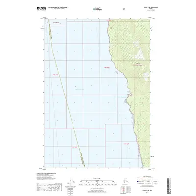
2017 Map of Sitka C-3 NE
USGS Topo · Published 2017About this map
Tongass National Forest dominates the eastern coastline of this maritime reach, where the interior wilderness meets the open waters of the Gulf of Alaska and the Pacific Ocean. The coastal topography is defined by the prominent Marble Bluffs, which rise sharply along the shoreline north of Marble Cove. This area serves as a significant boundary point between the Hoonah-Angoon Census Area and Sitka Borough. The survey reveals a landscape almost entirely devoid of human infrastructure, focusing instead on the complex shoreline geometry and the steep elevation contours of the national forest land, providing a clear record of the natural coastline before further environmental or geological shifts occur.
Find a feature on this map
12 named features on this map. Tap any name to fly to it.
Don’t see what you’re looking for? This feature index may not catch every label — zoom into the map to look around manually.
Map Details
Editions of this 2017 Sitka C-3 NE Map
This is the sole edition of this map. No revisions or reprints were ever made.
Other maps of this area

1948 · Sitka C-2
USGS Topo · 1:63,360

1948 · Sitka C-3
USGS Topo · 1:63,360

1948 · Sitka D-3
USGS Topo · 1:63,360

1948 · Sitka D-2
USGS Topo · 1:63,360

1951 · Sitka
USGS Topo · 1:250,000

1951 · Sitka D-3
USGS Topo · 1:63,360

1951 · Sitka C-3
USGS Topo · 1:63,360

1951 · Sitka D-2
USGS Topo · 1:63,360

1951 · Sitka C-2
USGS Topo · 1:63,360

1952 · Sitka
USGS Topo · 1:250,000