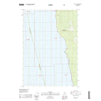
2021 Map of Sitka C-3 NE
USGS Topo · Published 2021About this map
Tongass National Forest dominates the eastern landscape of this coastal region, where steep terrain meets the waters of Southeast Alaska. Along the shoreline, Marble Bluffs stands as a prominent topographical landmark, overlooking the sheltered waters of Marble Cove. This coastal interface is part of a complex administrative landscape, defined here by the boundary of the Hoonah-Angoon Census Area and Sitka City and Borough. The map illustrates a wilderness area largely devoid of modern development, focusing instead on the natural elevation changes and the intricate shoreline that characterizes the Alexander Archipelago.
Find a feature on this map
10 named features on this map. Tap any name to fly to it.
Don’t see what you’re looking for? This feature index may not catch every label — zoom into the map to look around manually.
Map Details
Editions of this 2021 Sitka C-3 NE Map
This is the sole edition of this map. No revisions or reprints were ever made.
Other maps of this area

1948 · Sitka C-2
USGS Topo · 1:63,360

1948 · Sitka C-3
USGS Topo · 1:63,360

1948 · Sitka D-3
USGS Topo · 1:63,360

1948 · Sitka D-2
USGS Topo · 1:63,360

1951 · Sitka
USGS Topo · 1:250,000

1951 · Sitka D-3
USGS Topo · 1:63,360

1951 · Sitka C-3
USGS Topo · 1:63,360

1951 · Sitka D-2
USGS Topo · 1:63,360

1951 · Sitka C-2
USGS Topo · 1:63,360

1952 · Sitka
USGS Topo · 1:250,000