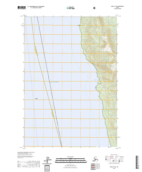
2024 Map of Sitka C-3 NE
USGS Topo · Published 2024About this map
Admiralty Island National Monument dominates the eastern half of this coastal survey, where the protected terrain of the Kootznoowoo Wilderness rises sharply from the shoreline. The map delineates the maritime boundary between the Sitka borough and the Hoonah-Angoon Census Area, a line that cuts through the Gulf of Alaska as it approaches the rugged coast of Tongass National Forest. Coastal features like Marble Cove and the prominent Marble Bluffs provide key landmarks for navigating this largely roadless area. This modern survey reflects the enduring preservation of the Admiralty Island landscape, where federal wilderness protections overlap with traditional borough divisions in one of the more remote reaches of Southeast Alaska.
Find a feature on this map
14 named features on this map. Tap any name to fly to it.
Don’t see what you’re looking for? This feature index may not catch every label — zoom into the map to look around manually.
Map Details
Editions of this 2024 Sitka C-3 NE Map
This is the sole edition of this map. No revisions or reprints were ever made.
Other maps of this area

1948 · Sitka C-2
USGS Topo · 1:63,360

1948 · Sitka C-3
USGS Topo · 1:63,360

1948 · Sitka D-3
USGS Topo · 1:63,360

1948 · Sitka D-2
USGS Topo · 1:63,360

1951 · Sitka
USGS Topo · 1:250,000

1951 · Sitka D-3
USGS Topo · 1:63,360

1951 · Sitka C-3
USGS Topo · 1:63,360

1951 · Sitka D-2
USGS Topo · 1:63,360

1951 · Sitka C-2
USGS Topo · 1:63,360

1952 · Sitka
USGS Topo · 1:250,000