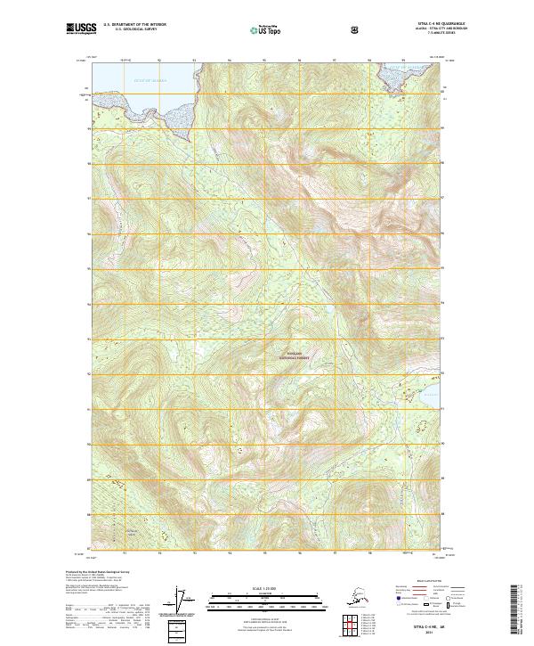
2021 Map of Sitka C-4 NE
USGS Topo · Published 2021About this map
Chichagof Island terrain dominates this coastal survey within the Tongass National Forest, where the Gulf of Alaska meets the northern shore. The landscape is defined by the Moore Mountains and a complex network of forest management roads and trails, including the Corner Bay Main Line and Corner Bay East. These routes provide access to interior points like Hook Pass and the Corner Bay Work Center near the coast.
Find a feature on this map
30 named features on this map. Tap any name to fly to it.
Don’t see what you’re looking for? This feature index may not catch every label — zoom into the map to look around manually.
Map Details
Editions of this 2021 Sitka C-4 NE Map
This is the sole edition of this map. No revisions or reprints were ever made.
Other maps of this area

1948 · Sitka C-3
USGS Topo · 1:63,360

1948 · Sitka D-3
USGS Topo · 1:63,360

1948 · Sitka D-4
USGS Topo · 1:63,360

1951 · Sitka C-4
USGS Topo · 1:63,360

1951 · Sitka
USGS Topo · 1:250,000

1951 · Sitka D-3
USGS Topo · 1:63,360

1951 · Sitka C-3
USGS Topo · 1:63,360

1952 · Sitka
USGS Topo · 1:250,000

1955 · Sitka D-4
USGS Topo · 1:63,360

1964 · Sitka
USGS Topo · 1:250,000