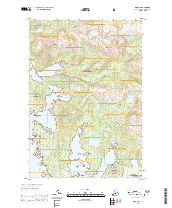
2021 Map of Sitka C-7 NE
USGS Topo · Published 2021About this map
Chichagof Island dominates this coastal survey, where the intricate shoreline of the Tongass National Forest meets the Pacific through passages like Ogden Passage and Slocum Passage. The landscape is defined by its dramatic relief, rising from the waters of Klag Bay and Kimshan Cove to prominent peaks such as Mt Lydonia and Goon Dip Mtn. The drainage patterns are clearly visible, with the Goon Dip River and Chichagof Cr carving through the timbered terrain.
Find a feature on this map
43 named features on this map. Tap any name to fly to it.
Don’t see what you’re looking for? This feature index may not catch every label — zoom into the map to look around manually.
Map Details
Editions of this 2021 Sitka C-7 NE Map
This is the sole edition of this map. No revisions or reprints were ever made.
Other maps of this area

1948 · Sitka C-7
USGS Topo · 1:63,360

1948 · Sitka C-6
USGS Topo · 1:63,360

1948 · Sitka D-6
USGS Topo · 1:63,360

1951 · Sitka D-7
USGS Topo · 1:63,360

1951 · Sitka
USGS Topo · 1:250,000

1951 · Sitka C-6
USGS Topo · 1:63,360

1951 · Sitka C-7
USGS Topo · 1:63,360

1951 · Sitka D-6
USGS Topo · 1:63,360

1952 · Sitka
USGS Topo · 1:250,000

1964 · Sitka
USGS Topo · 1:250,000