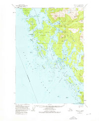
1951 Map of Sitka C-7
USGS Topo · Published 1976About this map
Chichagof Island and its surrounding archipelago define this coastal portion of the Tongass National Forest as it was surveyed in the early 1950s. The map captures a landscape dominated by intricate waterways and significant elevations, including Doolth Mountain and Mount Lydonia. These peaks overlook a complex network of channels such as Ogden Passage and Surveyor Passage, which weave through the Myriad Islands and around Herbert Graves Island.
Find a feature on this map
54 named features on this map. Tap any name to fly to it.
Don’t see what you’re looking for? This feature index may not catch every label — zoom into the map to look around manually.
Map Details
Editions of this 1951 Sitka C-7 Map
4 editions found
Other maps of this area

1948 · Sitka C-7
USGS Topo · 1:63,360

1948 · Sitka C-6
USGS Topo · 1:63,360

1948 · Sitka D-6
USGS Topo · 1:63,360

1948 · Sitka D-8
USGS Topo · 1:63,360

1950 · Sitka D-8
USGS Topo · 1:63,360

1951 · Sitka D-7
USGS Topo · 1:63,360

1951 · Sitka B-6
USGS Topo · 1:63,360

1951 · Sitka
USGS Topo · 1:250,000

1951 · Sitka C-6
USGS Topo · 1:63,360

1951 · Sitka C-7
USGS Topo · 1:63,360