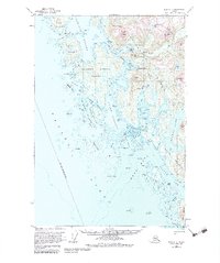
1951 Map of Sitka C-7
USGS Topo · Published 1983About this map
Chichagof and the surrounding coastline of the City and Borough of Sitka appear here during a period of active coastal navigation and mining exploration. This 1951 study, compiled from aerial photography and earlier hydrographic charts, detail the intricate waterways of the Tongass National Forest, including Ogden Passage and Slocum Arm. The settlement at Chichagof stands as a primary outpost on the western edge of Chichagof Island, connected to the interior via Chickagof Creek.
Find a feature on this map
74 named features on this map. Tap any name to fly to it.
Don’t see what you’re looking for? This feature index may not catch every label — zoom into the map to look around manually.
Map Details
Editions of this 1951 Sitka C-7 Map
4 editions found
Other maps of this area

1948 · Sitka C-7
USGS Topo · 1:63,360

1948 · Sitka C-6
USGS Topo · 1:63,360

1948 · Sitka D-6
USGS Topo · 1:63,360

1948 · Sitka D-8
USGS Topo · 1:63,360

1950 · Sitka D-8
USGS Topo · 1:63,360

1951 · Sitka D-7
USGS Topo · 1:63,360

1951 · Sitka B-6
USGS Topo · 1:63,360

1951 · Sitka
USGS Topo · 1:250,000

1951 · Sitka C-6
USGS Topo · 1:63,360

1951 · Sitka C-7
USGS Topo · 1:63,360