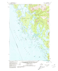
1951 Map of Sitka C-7
USGS Topo · Published 1981About this map
Chichagof stands as a primary outpost on the western coast of Chichagof Island, situated near the head of Klag Bay. This 1951 survey documents a landscape defined by an intricate network of waterways, including the narrow passages of Elbow Passage and Surveyor Passage that thread between Herbert Graves Island and the mainland. The area's geological and industrial character is evident through labels for Shale, Copper, and Vein deposits near Smooth Channel.
Find a feature on this map
95 named features on this map. Tap any name to fly to it.
Don’t see what you’re looking for? This feature index may not catch every label — zoom into the map to look around manually.
Map Details
Editions of this 1951 Sitka C-7 Map
4 editions found
Other maps of this area

1948 · Sitka C-7
USGS Topo · 1:63,360

1948 · Sitka C-6
USGS Topo · 1:63,360

1948 · Sitka D-6
USGS Topo · 1:63,360

1948 · Sitka D-8
USGS Topo · 1:63,360

1950 · Sitka D-8
USGS Topo · 1:63,360

1951 · Sitka D-7
USGS Topo · 1:63,360

1951 · Sitka B-6
USGS Topo · 1:63,360

1951 · Sitka
USGS Topo · 1:250,000

1951 · Sitka C-6
USGS Topo · 1:63,360

1951 · Sitka C-7
USGS Topo · 1:63,360