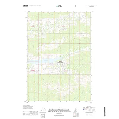
2021 Map of Sitka D-2 SW
USGS Topo · Published 2021About this map
Tongass National Forest dominates this coastal Alaska landscape, characterized by high-elevation terrain and significant freshwater bodies. Centrally located within the wilderness, Lake Florence is a prominent geographical feature fed and drained by the surrounding drainage networks. The drainage patterns include Ward Cr in the northern reaches and Fishery Cr in the south, both of which carve through the steep topography of the Alexander Archipelago. This 2021 survey illustrates a region defined by its lack of human infrastructure, focusing instead on the complex elevation contours and the hydrographic relationship between the forest's interior lakes and the creeks that navigate toward the coast. The absence of roads or established settlements emphasizes the primary role of the Tongass National Forest in preserving this undeveloped territory.
Find a feature on this map
8 named features on this map. Tap any name to fly to it.
Don’t see what you’re looking for? This feature index may not catch every label — zoom into the map to look around manually.
Map Details
Editions of this 2021 Sitka D-2 SW Map
This is the sole edition of this map. No revisions or reprints were ever made.
Other maps of this area

1948 · Sitka C-2
USGS Topo · 1:63,360

1948 · Sitka C-3
USGS Topo · 1:63,360

1948 · Sitka D-3
USGS Topo · 1:63,360

1948 · Sitka D-2
USGS Topo · 1:63,360

1951 · Sitka
USGS Topo · 1:250,000

1951 · Sitka D-3
USGS Topo · 1:63,360

1951 · Sitka C-3
USGS Topo · 1:63,360

1951 · Sitka D-2
USGS Topo · 1:63,360

1951 · Sitka C-2
USGS Topo · 1:63,360

1952 · Sitka
USGS Topo · 1:250,000