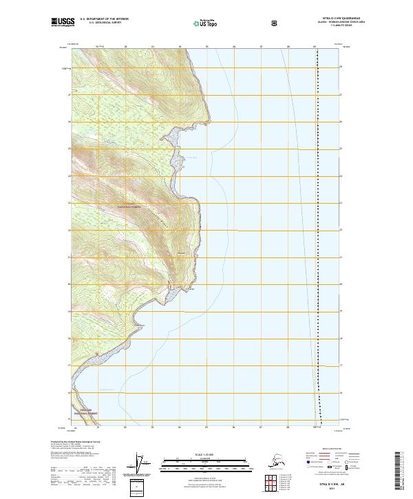
2021 Map of Sitka D-3 NW
USGS Topo · Published 2021About this map
Tongass National Forest dominates this coastal landscape in the Alexander Archipelago, where steep ridges meet the cold waters of Chatham Strait. The topography is defined by the high crest of Sonyakay Ridge and the Iyouktug highlands, with drainage flowing through several named waterways including Iyouktug Cr and Wukuklook Cr. The map reveals a specific industrial legacy through the Hoonah Gypsum labels, indicating the resource potential that shaped early 20th-century exploration in this region.
Find a feature on this map
20 named features on this map. Tap any name to fly to it.
Don’t see what you’re looking for? This feature index may not catch every label — zoom into the map to look around manually.
Map Details
Editions of this 2021 Sitka D-3 NW Map
This is the sole edition of this map. No revisions or reprints were ever made.
Other maps of this area

1948 · Juneau A-3
USGS Topo · 1:63,360

1948 · Juneau A-4
USGS Topo · 1:63,360

1948 · Sitka D-3
USGS Topo · 1:63,360

1948 · Sitka D-4
USGS Topo · 1:63,360

1950 · Juneau A-3
USGS Topo · 1:63,360

1951 · Juneau
USGS Topo · 1:250,000

1951 · Sitka
USGS Topo · 1:250,000

1951 · Sitka D-3
USGS Topo · 1:63,360

1952 · Sitka
USGS Topo · 1:250,000

1955 · Sitka D-4
USGS Topo · 1:63,360