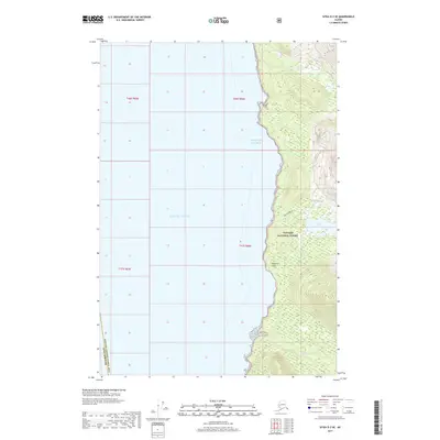
2017 Map of Sitka D-3 SE
USGS Topo · Published 2017About this map
Tongass National Forest dominates this coastal landscape where the western edge of Admiralty Island meets the Gulf of Alaska. The terrain is characterized by steep coastal drainages and significant inland water bodies, most notably the large expanse of Lake Florence. This wilderness area is partitioned by the boundary between the Sitka Borough and the Hoonah-Angoon Census Area, reflecting the complex administrative geography of Southeast Alaska. Coastal features such as Fishery Point and the mouth of Fishery Cr provide specific points of reference along a shoreline defined by deep inlets and narrow waterways like Ward Cr. The map illustrates a remote, undeveloped maritime environment where the primary landmarks are natural water systems and federal forest boundaries.
Find a feature on this map
13 named features on this map. Tap any name to fly to it.
Don’t see what you’re looking for? This feature index may not catch every label — zoom into the map to look around manually.
Map Details
Editions of this 2017 Sitka D-3 SE Map
This is the sole edition of this map. No revisions or reprints were ever made.
Other maps of this area

1948 · Sitka C-2
USGS Topo · 1:63,360

1948 · Sitka C-3
USGS Topo · 1:63,360

1948 · Sitka D-3
USGS Topo · 1:63,360

1948 · Sitka D-2
USGS Topo · 1:63,360

1951 · Sitka
USGS Topo · 1:250,000

1951 · Sitka D-3
USGS Topo · 1:63,360

1951 · Sitka C-3
USGS Topo · 1:63,360

1951 · Sitka D-2
USGS Topo · 1:63,360

1951 · Sitka C-2
USGS Topo · 1:63,360

1952 · Sitka
USGS Topo · 1:250,000