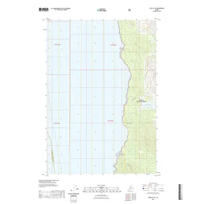
2021 Map of Sitka D-3 SE
USGS Topo · Published 2021About this map
Coastal drainages and dense topographic contours define this portion of the Unorganized Borough, where Ward Cr flows toward the western coastline. Situated within the southern reaches of the Tongass National Forest, the landscape is dominated by the intricate interplay of steep maritime terrain and seasonal wetlands. The map details the administrative boundaries of the Public Land Survey System, including sections within t46s r65e, t46s r66e, t47s r65e, and t47s r66e. This 2021 survey illustrates a largely roadless wilderness, preserving the natural drainage patterns of the Alaskan panhandle's rugged coastal fringe.
Find a feature on this map
5 named features on this map. Tap any name to fly to it.
Don’t see what you’re looking for? This feature index may not catch every label — zoom into the map to look around manually.
Map Details
Editions of this 2021 Sitka D-3 SE Map
This is the sole edition of this map. No revisions or reprints were ever made.
Other maps of this area

1948 · Sitka C-2
USGS Topo · 1:63,360

1948 · Sitka C-3
USGS Topo · 1:63,360

1948 · Sitka D-3
USGS Topo · 1:63,360

1948 · Sitka D-2
USGS Topo · 1:63,360

1951 · Sitka
USGS Topo · 1:250,000

1951 · Sitka D-3
USGS Topo · 1:63,360

1951 · Sitka C-3
USGS Topo · 1:63,360

1951 · Sitka D-2
USGS Topo · 1:63,360

1951 · Sitka C-2
USGS Topo · 1:63,360

1952 · Sitka
USGS Topo · 1:250,000