
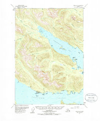
1955 Map of Sitka D-4
USGS Topo · Published 1961About this map
Chichagof Island serves as the backdrop for this mid-century look at the maritime and wilderness life along the Tenakee Inlet. The settlement of Tenakee (Tenakee Springs PO) sits at the heart of human activity on the southern shore, featuring a Campground and a coastal Light to guide vessels. This area reflects a reliance on the sea and natural resources, with evidence of early local history found in the Cem and Grave markers near the shoreline.
Find a feature on this map
32 named features on this map. Tap any name to fly to it.
Don’t see what you’re looking for? This feature index may not catch every label — zoom into the map to look around manually.
Map Details
Editions of this 1955 Sitka D-4 Map
2 editions found
Other maps of this area

1948 · Juneau A-3
USGS Topo · 1:63,360

1948 · Juneau A-4
USGS Topo · 1:63,360

1948 · Sitka C-3
USGS Topo · 1:63,360

1948 · Sitka D-5
USGS Topo · 1:63,360

1948 · Sitka D-3
USGS Topo · 1:63,360

1948 · Sitka D-4
USGS Topo · 1:63,360

1950 · Juneau A-3
USGS Topo · 1:63,360

1951 · Juneau
USGS Topo · 1:250,000

1951 · Juneau A-5
USGS Topo · 1:63,360

1951 · Sitka C-5
USGS Topo · 1:63,360