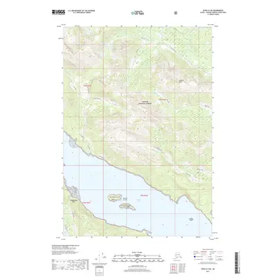
2017 Map of Sitka D-4 NE
USGS Topo · Published 2017About this map
Tongass National Forest dominates this coastal landscape on Chichagof Island, where the dense wilderness meets the inlets of Freshwater Bay. The map records a network of forest roads and spurs that penetrate the steep, timbered slopes, including Seal Creek and Hoonah Gypsum, reflecting the region's history of resource management and extraction. Named watercourses like Wukuklook Cr and Gypsum Cr drain the high elevations of Sonyakay Ridge, flowing toward the sheltered waters where the Redcliff Islands and Heidi Rock sit offshore. This 2017 survey provides a high-resolution look at the geographic interface between the inland waterways and the mountainous interior, marking several named peaks and ridges such as Sonya Kay and Kay 1.
Find a feature on this map
31 named features on this map. Tap any name to fly to it.
Don’t see what you’re looking for? This feature index may not catch every label — zoom into the map to look around manually.
Map Details
Editions of this 2017 Sitka D-4 NE Map
This is the sole edition of this map. No revisions or reprints were ever made.
Other maps of this area

1948 · Juneau A-3
USGS Topo · 1:63,360

1948 · Juneau A-4
USGS Topo · 1:63,360

1948 · Sitka D-3
USGS Topo · 1:63,360

1948 · Sitka D-4
USGS Topo · 1:63,360

1950 · Juneau A-3
USGS Topo · 1:63,360

1951 · Juneau
USGS Topo · 1:250,000

1951 · Sitka
USGS Topo · 1:250,000

1951 · Sitka D-3
USGS Topo · 1:63,360

1952 · Sitka
USGS Topo · 1:250,000

1955 · Sitka D-4
USGS Topo · 1:63,360