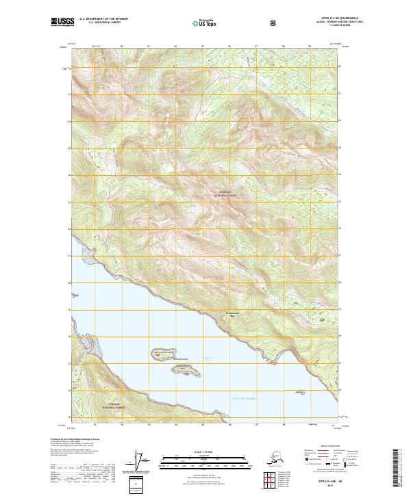
2021 Map of Sitka D-4 NE
USGS Topo · Published 2021About this map
Freshwater Bay dominates this coastal survey, where the saltwater inlet meets the managed timberlands of the Tongass National Forest. The map documents a complex network of forest access routes, including Seal Creek Spur 1 and Seal Creek 3, which reflect the region's legacy of industrial forest management. Along the shoreline, navigational markers and geographical features like Heidi Rock and the Redcliff Islands—comprising both West Redcliff Island and East Redcliff Island—define the maritime approach. High-elevation landmarks such as Sonya Kay Ridge separate various drainages, including Iyouktug Cr and Wukuklook Cr, which flow toward the Gulf of Alaska. This detailed 2021 update captures the modern state of the wilderness infrastructure, from the tidal flats of Kennel Cr to the named spurs and valleys that characterize this corner of the Chichagof Island landscape.
Find a feature on this map
26 named features on this map. Tap any name to fly to it.
Don’t see what you’re looking for? This feature index may not catch every label — zoom into the map to look around manually.
Map Details
Editions of this 2021 Sitka D-4 NE Map
This is the sole edition of this map. No revisions or reprints were ever made.
Other maps of this area

1948 · Juneau A-3
USGS Topo · 1:63,360

1948 · Juneau A-4
USGS Topo · 1:63,360

1948 · Sitka D-3
USGS Topo · 1:63,360

1948 · Sitka D-4
USGS Topo · 1:63,360

1950 · Juneau A-3
USGS Topo · 1:63,360

1951 · Juneau
USGS Topo · 1:250,000

1951 · Sitka
USGS Topo · 1:250,000

1951 · Sitka D-3
USGS Topo · 1:63,360

1952 · Sitka
USGS Topo · 1:250,000

1955 · Sitka D-4
USGS Topo · 1:63,360