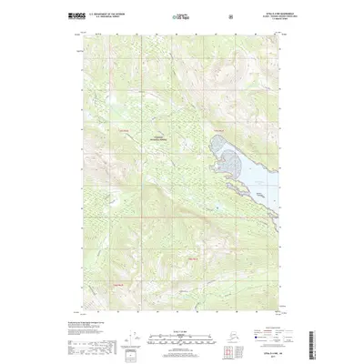
2017 Map of Sitka D-4 NW
USGS Topo · Published 2017About this map
Tongass National Forest dominates this Alaskan landscape, where the coastal waters of Freshwater Bay meet the high, wooded interior. The map focuses on a complex network of waterways and glacial drainages, most notably the N Fork Freshwater Cr and Poodle Creek, which flow toward the eastern shoreline. Offshore, Rainier Island sits near the mouth of the bay, marking a transition between the protected waters and the open inlet. Human activity is sparse and primarily confined to the Indian River Road in the southwest and various forest service designations like Block 28 HRD. The survey also documents the intricate paths of Kennel Cr and Seal Creek, providing a look at the natural drainage patterns of the Chichagof Island vicinity before significant modern alteration.
Find a feature on this map
23 named features on this map. Tap any name to fly to it.
Don’t see what you’re looking for? This feature index may not catch every label — zoom into the map to look around manually.
Map Details
Editions of this 2017 Sitka D-4 NW Map
This is the sole edition of this map. No revisions or reprints were ever made.
Other maps of this area

1948 · Juneau A-4
USGS Topo · 1:63,360

1948 · Sitka D-5
USGS Topo · 1:63,360

1948 · Sitka D-4
USGS Topo · 1:63,360

1951 · Juneau
USGS Topo · 1:250,000

1951 · Juneau A-5
USGS Topo · 1:63,360

1951 · Sitka
USGS Topo · 1:250,000

1951 · Sitka D-5
USGS Topo · 1:63,360

1952 · Sitka
USGS Topo · 1:250,000

1955 · Sitka D-4
USGS Topo · 1:63,360

1962 · Juneau
USGS Topo · 1:250,000