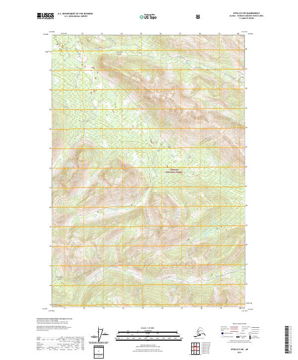
2021 Map of Sitka D-5 NE
USGS Topo · Published 2021About this map
Chichagof Island terrain dominates this survey of the Alaskan wilderness, primarily contained within the boundaries of the Tongass National Forest. The landscape is defined by a dense network of drainages and waterways, including Game Creek, Ten Mile Creek, and Freshwater Cr. These systems carve through the interior, with Middle Drain providing a distinct geographic marker amidst the high-relief topography. The northern reaches of the map feature the Kulichkof Reefs and several forks of the Freshwater system, such as North Fork Za. Human activity in this largely undeveloped area is indicated by the presence of a Rock Pit in the northwest, suggesting localized resource extraction or road maintenance within the forest. The map provides a precise look at the township and range lines, such as t45s r62e, which organize this portion of the Alexander Archipelago.
Find a feature on this map
16 named features on this map. Tap any name to fly to it.
Don’t see what you’re looking for? This feature index may not catch every label — zoom into the map to look around manually.
Map Details
Editions of this 2021 Sitka D-5 NE Map
This is the sole edition of this map. No revisions or reprints were ever made.
Other maps of this area

1948 · Juneau A-4
USGS Topo · 1:63,360

1948 · Sitka D-5
USGS Topo · 1:63,360

1948 · Sitka D-4
USGS Topo · 1:63,360

1951 · Juneau
USGS Topo · 1:250,000

1951 · Juneau A-5
USGS Topo · 1:63,360

1951 · Sitka
USGS Topo · 1:250,000

1951 · Sitka D-5
USGS Topo · 1:63,360

1952 · Sitka
USGS Topo · 1:250,000

1955 · Sitka D-4
USGS Topo · 1:63,360

1962 · Juneau
USGS Topo · 1:250,000