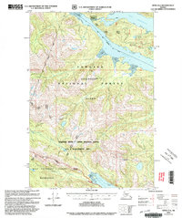
2000 Map of Sitka D-6
USGS Topo · Published 2003About this map
Chichagof Island serves as the backdrop for this millennium-era update, which documents the remote terrain of the Alexander Archipelago at the turn of the century. Published by the U.S. Geological Survey and revised by the Forest Service, the sheet highlights protected lands like the West Chichagof Yakobi Wilderness and the Lisianski River Upper Hoonah Sound LUD II Management Area. The settlement at Portage sits near the head of Port Frederick, reflecting the isolated living patterns of the Alaskan panhandle. The topography is defined by significant waterways such as Tenakee Inlet and the North Arm Hoonah Sound, which cut deep into the timbered interior. Genealogists and researchers can trace local landmarks like the Radio Repeater and the narrow drainage of Granite Creek as they appeared just before contemporary digital mapping became standard.
Find a feature on this map
19 named features on this map. Tap any name to fly to it.
Don’t see what you’re looking for? This feature index may not catch every label — zoom into the map to look around manually.
Map Details
Editions of this 2000 Sitka D-6 Map
This is the sole edition of this map. No revisions or reprints were ever made.
Other maps of this area

1948 · Sitka C-7
USGS Topo · 1:63,360

1948 · Sitka D-5
USGS Topo · 1:63,360

1948 · Sitka C-6
USGS Topo · 1:63,360

1948 · Sitka D-6
USGS Topo · 1:63,360

1948 · Mount Fairweather A-1
USGS Topo · 1:63,360

1951 · Juneau
USGS Topo · 1:250,000

1951 · Juneau A-6
USGS Topo · 1:63,360

1951 · Juneau A-5
USGS Topo · 1:63,360

1951 · Sitka D-7
USGS Topo · 1:63,360

1951 · Mt Fairweather
USGS Topo · 1:250,000