
1948 Map of Sitka D-8
USGS Topo · Published 1962About this map
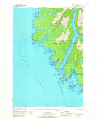
Yakobi Island and the western edge of Chichagof Island define this coastal survey, where the intricate shoreline of the Pacific Ocean meets the interior waters of Southeast Alaska. The landscape is dominated by the narrow Lisianski Strait and the mountainous interior of the Tongass National Forest, rising to summits like Takanis Peak and Pinnacle Mountain. Small outposts such as Mindalina, Greentop, and White Sulphur Springs indicate the localized human presence along these remote waterways, likely serving as seasonal camps or resource points.
Find a feature on this map
40 named features on this map. Tap any name to fly to it.
Don’t see what you’re looking for? This feature index may not catch every label — zoom into the map to look around manually.
Map Details
Editions of this 1948 Sitka D-8 Map
3 editions found
Other maps of this area

1948 · Sitka C-7
USGS Topo · 1:63,360

1948 · Mount Fairweather A-2
USGS Topo · 1:63,360

1948 · Mount Fairweather A-1
USGS Topo · 1:63,360

1950 · Sitka D-8
USGS Topo · 1:63,360

1951 · Sitka D-7
USGS Topo · 1:63,360

1951 · Mt Fairweather
USGS Topo · 1:250,000

1951 · Sitka
USGS Topo · 1:250,000

1951 · Sitka C-7
USGS Topo · 1:63,360

1952 · Sitka
USGS Topo · 1:250,000

1954 · Mount Fairweather A-1
USGS Topo · 1:63,360