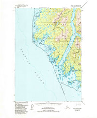
1948 Map of Sitka D-8
USGS Topo · Published 1984About this map
Yakobi Island and the western edge of Chichagof Island define this coastal survey, where the Pacific Ocean meets a complex network of inlets and straits. Grounded in 1948 topography, the map reveals a landscape defined by maritime activity and resource extraction, notably featuring Mines and the Bohemia Basin in the northern reaches. The area is characterized by protective harbors and rugged coastal points like Cape Cross and Pt Theodore.
Find a feature on this map
49 named features on this map. Tap any name to fly to it.
Don’t see what you’re looking for? This feature index may not catch every label — zoom into the map to look around manually.
Map Details
Editions of this 1948 Sitka D-8 Map
3 editions found
Other maps of this area

1948 · Sitka C-7
USGS Topo · 1:63,360

1948 · Mount Fairweather A-2
USGS Topo · 1:63,360

1948 · Sitka D-8
USGS Topo · 1:63,360

1948 · Mount Fairweather A-1
USGS Topo · 1:63,360

1950 · Sitka D-8
USGS Topo · 1:63,360

1951 · Sitka D-7
USGS Topo · 1:63,360

1951 · Mt Fairweather
USGS Topo · 1:250,000

1951 · Sitka
USGS Topo · 1:250,000

1951 · Sitka C-7
USGS Topo · 1:63,360

1952 · Sitka
USGS Topo · 1:250,000