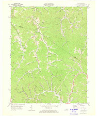
1971 Map of Sitka
USGS Topo · Published 1973About this map
Blaine Creek and its complex network of forks define the rural topography of Johnson and Lawrence Counties in the early 1970s. This survey captures a moment when the eastern Kentucky landscape was heavily utilized for extraction, evidenced by the dense concentration of Gas Wells and coal Mines dotting the hollows near Sitka and Stambaugh. Small communities like Davisville and Chandlerville serve as anchors for local life, connected by winding roads that follow the valley floors of Hood Fork and Rockhouse Fork.
Find a feature on this map
71 named features on this map. Tap any name to fly to it.
Don’t see what you’re looking for? This feature index may not catch every label — zoom into the map to look around manually.
Map Details
Editions of this 1971 Sitka Map
2 editions found
Other maps of this area

1886 · Prestonsburg
USGS Topo · 1:125,000

1892 · Prestonsburg
USGS Topo · 1:125,000

1903 · Kenova
USGS Topo · 1:125,000

1904 · Kenova
USGS Topo · 1:125,000

1911 · Louisa
USGS Topo · 1:48,000

1913 · Louisa
USGS Topo · 1:62,500

1914 · Inez
USGS Topo · 1:48,000

1915 · Paintsville
USGS Topo · 1:48,000

1916 · Inez
USGS Topo · 1:62,500

1917 · Paintsville
USGS Topo · 1:62,500