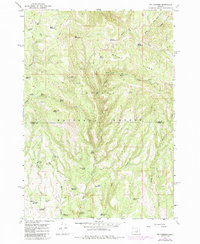
1966 Map of Six Corners
USGS Topo · Published 1985About this map
The Ochogo National Forest dominates this mid-1960s landscape, illustrating a high-desert forest environment defined by livestock management and water conservation. The map reveals an extensive system of springs and man-made impoundments such as Reed Reservoir, Scab Reservoir, and Clayton Reservoir, which are vital for both wildlife and grazing operations on the ridge. The settlement of Six Corners serves as a small waypoint near Thornton Creek, while the broader terrain is marked by numerous family or descriptively named meadows, including Bear Meadows, Squaw Meadows, and Potter Meadows. Topography is characterized by the prominent Bear Mountain and the dividing line between Wheeler County and Crook County. The map also documents resource extraction through scattered pits, a Quarry, and a Gravel Pit, alongside public recreation at the Wolf Creek Campground.
Find a feature on this map
48 named features on this map. Tap any name to fly to it.
Don’t see what you’re looking for? This feature index may not catch every label — zoom into the map to look around manually.
Map Details
Editions of this 1966 Six Corners Map
2 editions found
Other maps of this area

1932 · Dayville
USGS Topo · 1:125,000

1936 · Dayville
USGS Topo · 1:125,000

1955 · Canyon City
USGS Topo · 1:250,000

1959 · Canyon City
USGS Topo · 1:250,000

1966 · Antone
USGS Topo · 1:24,000
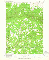
1966 · Derr Meadows
USGS Topo · 1:24,000

1966 · Little Summit Prairie
USGS Topo · 1:24,000

1966 · Six Corners
USGS Topo · 1:24,000

1972 · Wolf Mountain
USGS Topo · 1:24,000

1972 · Day Basin
USGS Topo · 1:24,000