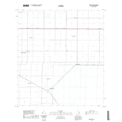
2021 Map of Sixmile Bend
USGS Topo · Published 2021About this map
The agricultural landscape of the northern Everglades dominates this survey, defined by the geometry of large-scale water management and sugar industry infrastructure. Sixmile Bend and Ninemile Bend serve as key navigational points along the Hillsboro Canal, a major artery that cuts diagonally across the southern half of the map. The settlement of Belle Glade appears on the western edge, marking the transition from the town’s outskirts into the vast cultivated tracts of the t43s r37e and t43s r38e townships.
Find a feature on this map
20 named features on this map. Tap any name to fly to it.
Don’t see what you’re looking for? This feature index may not catch every label — zoom into the map to look around manually.
Map Details
Editions of this 2021 Sixmile Bend Map
This is the sole edition of this map. No revisions or reprints were ever made.
Other maps of this area

1956 · West Palm Beach
USGS Topo · 1:250,000

1957 · West Palm Beach
USGS Topo · 1:250,000

1958 · West Palm Beach
USGS Topo · 1:250,000

1970 · Belle Glade
USGS Topo · 1:24,000

1970 · West Palm Beach 2 SW
USGS Topo · 1:24,000

1970 · Okeelanta
USGS Topo · 1:24,000

1970 · Loxahatchee NW
USGS Topo · 1:24,000

1970 · Loxahatchee SW
USGS Topo · 1:24,000

1970 · Pahokee
USGS Topo · 1:24,000

1970 · Shawano
USGS Topo · 1:24,000