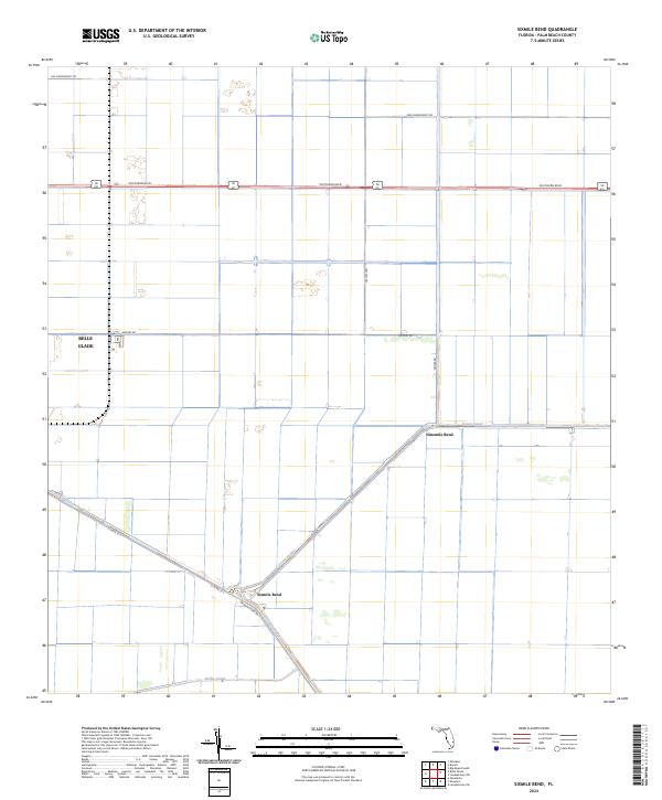
2024 Map of Sixmile Bend
USGS Topo · Published 2024About this map
Hillsboro Canal and Ocean Canal cut through the distinctive agricultural grid of the northern Everglades in this modern topographic study. The landscape is defined by its rectilinear drainage system, where the intersection of water and road networks facilitates the region's intensive farming operations. Belle Glade anchors the western edge, while the named junctions of Sixmile Bend and Ninemile Bend mark historic transit points along the canal banks. This survey illustrates the contemporary infrastructure of Palm Beach County, featuring heavy-duty thoroughfares like Southern Blvd and Hatton Hwy that connect the inland farming communities to the coast. Smaller local routes such as Brown's Farm Rd and Airport Rd weave between the expansive rectangular plots, providing a clear view of the modern land-use patterns in this part of South Florida.
Find a feature on this map
19 named features on this map. Tap any name to fly to it.
Don’t see what you’re looking for? This feature index may not catch every label — zoom into the map to look around manually.
Map Details
Editions of this 2024 Sixmile Bend Map
This is the sole edition of this map. No revisions or reprints were ever made.
Other maps of this area

1956 · West Palm Beach
USGS Topo · 1:250,000

1957 · West Palm Beach
USGS Topo · 1:250,000

1958 · West Palm Beach
USGS Topo · 1:250,000

1970 · Belle Glade
USGS Topo · 1:24,000

1970 · West Palm Beach 2 SW
USGS Topo · 1:24,000

1970 · Okeelanta
USGS Topo · 1:24,000

1970 · Loxahatchee NW
USGS Topo · 1:24,000

1970 · Loxahatchee SW
USGS Topo · 1:24,000

1970 · Pahokee
USGS Topo · 1:24,000

1970 · Shawano
USGS Topo · 1:24,000