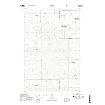
2017 Map of Skaar
USGS Topo · Published 2017About this map
Skaar sits at the intersection of McKenzie, Golden Valley, and Wibaux counties, marking a point where the North Dakota and Montana state lines meet. This landscape is defined by the protected expanse of the Little Missouri National Grassland, which covers much of the eastern half of the survey area. The terrain is deeply carved by a network of seasonal watercourses, most notably the branches of Smith Cr, including the N Fork Smith Cr and S Fork Smith Cr. Other drainages such as Poison Spring Cr and C S Cr thread through the cattle-country topography. Local transit is dictated by section-line and creek-following routes like Smith Creek Rd, Vinquist Rd, and Cs Creek Rd, illustrating the intersection of modern grazing management and the historic Public Land Survey System grid.
Find a feature on this map
23 named features on this map. Tap any name to fly to it.
Don’t see what you’re looking for? This feature index may not catch every label — zoom into the map to look around manually.
Map Details
Editions of this 2017 Skaar Map
This is the sole edition of this map. No revisions or reprints were ever made.
Other maps of this area

1909 · Glendive
USGS Topo · 1:250,000

1953 · Watford City
USGS Topo · 1:250,000

1954 · Glendive
USGS Topo · 1:250,000

1957 · Glendive
USGS Topo · 1:250,000

1957 · Watford City
USGS Topo · 1:250,000

1958 · Glendive
USGS Topo · 1:250,000

1966 · Skaar NW
USGS Topo · 1:24,000

1967 · Watford City
USGS Topo · 1:250,000

1974 · Hootowl Creek West
USGS Topo · 1:24,000

1974 · Trotters
USGS Topo · 1:24,000