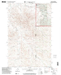
1997 Map of Skaar
USGS Topo · Published 2001About this map
The Little Missouri National Grassland dominates the eastern half of this landscape, where the Little Missouri River meets its North Fork and South Fork. This 1997 revision by the Forest Service captures a pocket of the Badlands along the border of North Dakota and Montana, defined by the erosion-carved drainage systems of Smith Creek, Poison Creek, and Deadman Creek. Small-scale ranching and mineral extraction characterize the human footprint here, centered around the settlement of Skaar and the Metcalf Ranch. In the southeast, a Scoria Pit indicates the local use of heat-fired clay for road surfacing, a common practice in this geological region. The map tracks a network of 4wd trails that cross the county lines of Wibaux, McKenzie, and Golden Valley, following the natural contours of the high plains.
Find a feature on this map
18 named features on this map. Tap any name to fly to it.
Don’t see what you’re looking for? This feature index may not catch every label — zoom into the map to look around manually.
Map Details
Editions of this 1997 Skaar Map
This is the sole edition of this map. No revisions or reprints were ever made.
Other maps of this area

1909 · Glendive
USGS Topo · 1:250,000

1953 · Watford City
USGS Topo · 1:250,000

1954 · Glendive
USGS Topo · 1:250,000

1957 · Glendive
USGS Topo · 1:250,000

1957 · Watford City
USGS Topo · 1:250,000

1958 · Glendive
USGS Topo · 1:250,000

1966 · Skaar NW
USGS Topo · 1:24,000

1967 · Watford City
USGS Topo · 1:250,000

1974 · Hootowl Creek West
USGS Topo · 1:24,000

1974 · Trotters
USGS Topo · 1:24,000