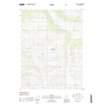
2017 Map of Skagway A-1 NE
USGS Topo · Published 2017About this map
Katzehin River flows through the northern reaches of this glacial terrain, cutting a broad valley through the high peaks of the Coast Range. The landscape is almost entirely defined by the protected wilderness of the Tongass National Forest, where steep elevation gradients are marked by an eighty-foot contour interval. This 2017 survey shows a region where natural hydrography and vertical relief dictate the geography, with the braided channels of the river basin providing the only significant break in the mountainous topography. The map detail reflects the untouched character of this coastal Alaskan interior, emphasizing the vast scales of the National Forest system before it meets the sea.
Find a feature on this map
9 named features on this map. Tap any name to fly to it.
Don’t see what you’re looking for? This feature index may not catch every label — zoom into the map to look around manually.
Map Details
Editions of this 2017 Skagway A-1 NE Map
This is the sole edition of this map. No revisions or reprints were ever made.
Other maps of this area

1948 · Skagway A-1
USGS Topo · 1:63,360

1949 · Atlin
USGS Topo · 1:250,000

1949 · Skagway B-1
USGS Topo · 1:63,360

1951 · Skagway A-1
USGS Topo · 1:63,360

1951 · Atlin
USGS Topo · 1:250,000

1951 · Skagway B-1
USGS Topo · 1:63,360

1952 · Skagway
USGS Topo · 1:250,000

1960 · Atlin A-8
USGS Topo · 1:63,360
1960 · Atlin B-8
USGS Topo · 1:63,360

1960 · Atlin
USGS Topo · 1:250,000