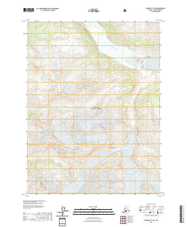
2021 Map of Skagway A-1 NE
USGS Topo · Published 2021About this map
Katzehin River flows through the upper portion of this quadrangle, carving a path through the glacial landscapes of the Coast Range. This 2021 survey illustrates the dramatic ice and rock formations that define the northern reaches of the Tongass National Forest in Southeast Alaska. The map highlights the high-elevation peaks and extensive glacial fields that characterize this portion of the Coast Range, providing a clear view of the hydrography and elevation before the river meets the Lynn Canal. The survey is primarily an environmental and topographic record of a wilderness area where the natural drainage of the Katzehin River serves as the primary geographic feature amidst the surrounding mountain system.
Find a feature on this map
10 named features on this map. Tap any name to fly to it.
Don’t see what you’re looking for? This feature index may not catch every label — zoom into the map to look around manually.
Map Details
Editions of this 2021 Skagway A-1 NE Map
This is the sole edition of this map. No revisions or reprints were ever made.
Other maps of this area

1948 · Skagway A-1
USGS Topo · 1:63,360

1949 · Atlin
USGS Topo · 1:250,000

1949 · Skagway B-1
USGS Topo · 1:63,360

1951 · Skagway A-1
USGS Topo · 1:63,360

1951 · Atlin
USGS Topo · 1:250,000

1951 · Skagway B-1
USGS Topo · 1:63,360

1952 · Skagway
USGS Topo · 1:250,000

1960 · Atlin A-8
USGS Topo · 1:63,360
1960 · Atlin B-8
USGS Topo · 1:63,360

1960 · Atlin
USGS Topo · 1:250,000