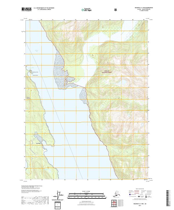
2021 Map of Skagway A-1 NW
USGS Topo · Published 2021About this map
Tongass National Forest dominates the eastern elevation of this coastal survey, where steep mountain slopes meet the glacial waters of the Katzehin River. This landscape is defined by the narrow, rocky finger of the Chilkat Peninsula, which separates the sheltered Mud Bay from the primary waterway of Chilkoot Inlet. The coastal topography includes distinctive navigation markers such as Battery Point and the nearby False Battery Point, along with hazards like Johnson Rock.
Find a feature on this map
20 named features on this map. Tap any name to fly to it.
Don’t see what you’re looking for? This feature index may not catch every label — zoom into the map to look around manually.
Map Details
Editions of this 2021 Skagway A-1 NW Map
This is the sole edition of this map. No revisions or reprints were ever made.
Other maps of this area

1948 · Skagway A-1
USGS Topo · 1:63,360

1949 · Skagway B-1
USGS Topo · 1:63,360

1951 · Skagway A-1
USGS Topo · 1:63,360

1951 · Skagway B-1
USGS Topo · 1:63,360

1952 · Skagway
USGS Topo · 1:250,000

1954 · Skagway B-2
USGS Topo · 1:63,360

1954 · Skagway A-2
USGS Topo · 1:63,360

1961 · Skagway
USGS Topo · 1:250,000
1991 · Skagway A-1 NW
USGS Topo · 1:25,000
1991 · Skagway B-2 SE
USGS Topo · 1:25,000