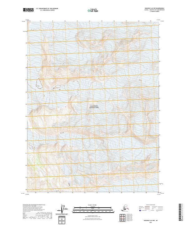
2021 Map of Skagway A-8 NW
USGS Topo · Published 2021About this map
Saint Elias Mountains dominate this high-altitude landscape within the northern reaches of Glacier Bay National Park. The survey focuses on the intricate glacial and mountain terrain along the boundary of the t31s r44e and t31s r45e townships. A primary highlight of the sheet is the presence of the Alsek Glacier, which carves through the frozen topography of the Yakutat area. The map illustrates the complex contouring of this ice-dominated region, where elevation and ice flow are the defining characteristics. This modern topographic record is essential for understanding the contemporary state of these protected wilderness lands and the massive ice fields that have shaped the Alsek River corridor over centuries.
Find a feature on this map
7 named features on this map. Tap any name to fly to it.
Don’t see what you’re looking for? This feature index may not catch every label — zoom into the map to look around manually.
Map Details
Editions of this 2021 Skagway A-8 NW Map
This is the sole edition of this map. No revisions or reprints were ever made.
Other maps of this area

1951 · Yakutat
USGS Topo · 1:250,000

1952 · Skagway
USGS Topo · 1:250,000

1959 · Yakutat A-1
USGS Topo · 1:63,360

1959 · Yakutat B-1
USGS Topo · 1:63,360

1959 · Yakutat
USGS Topo · 1:250,000
1961 · Skagway B-8
USGS Topo · 1:63,360

1961 · Skagway A-8
USGS Topo · 1:63,360

1961 · Skagway
USGS Topo · 1:250,000

1997 · Yakutat B-1
USGS Topo · 1:63,360
2017 · Yakutat A-1 NE
USGS Topo · 1:25,000