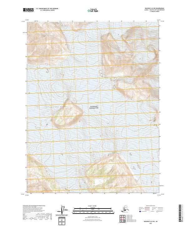
2021 Map of Skagway A-8 SW
USGS Topo · Published 2021About this map
Glacier Bay National Park dominates this portion of the Alaskan coast, where the massive ice fields and high peaks of the Saint Elias Mountains meet the sea. The landscape is defined by the immense flow of the Grand Plateau Glacier, which occupies a significant portion of the western terrain. The mapping reflects a wilderness area where natural boundaries and township lines of the t33s r45e and t32s r45e blocks provide the only human-imposed structure. There are no permanent settlements or road networks shown, emphasizing the scale of the glacial system and the preservation of this remote coastal environment as it existed in the early twenty-first century.
Find a feature on this map
9 named features on this map. Tap any name to fly to it.
Don’t see what you’re looking for? This feature index may not catch every label — zoom into the map to look around manually.
Map Details
Editions of this 2021 Skagway A-8 SW Map
This is the sole edition of this map. No revisions or reprints were ever made.
Other maps of this area

1951 · Yakutat
USGS Topo · 1:250,000

1951 · Mt Fairweather
USGS Topo · 1:250,000

1952 · Skagway
USGS Topo · 1:250,000

1959 · Yakutat A-1
USGS Topo · 1:63,360

1959 · Yakutat
USGS Topo · 1:250,000
1961 · Mount Fairweather D-7
USGS Topo · 1:63,360

1961 · Mount Fairweather D-6
USGS Topo · 1:63,360

1961 · Skagway A-8
USGS Topo · 1:63,360

1961 · Mt Fairweather
USGS Topo · 1:250,000

1961 · Skagway
USGS Topo · 1:250,000