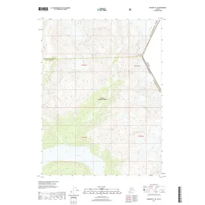
2017 Map of Skagway B-1 SE
USGS Topo · Published 2017About this map
Canada United States of America border markings define the eastern edge of this landscape, where the international line cuts across the high terrain of Mt Bagot. This 2017 survey documents a wilderness region dominated by the Tongass National Forest, illustrating the intricate topography that characterizes the boundary between Skagway Municipality and Haines Borough. In the southern portion of the sheet, the Katzehin River flows through deep glacial valleys, revealing the drainage patterns typical of this northern coastal environment. The map captures a moment in the modern era of land management, showing the precise township and range divisions such as t29s r61e and t30s r62e that overlay these protected federal lands.
Find a feature on this map
11 named features on this map. Tap any name to fly to it.
Don’t see what you’re looking for? This feature index may not catch every label — zoom into the map to look around manually.
Map Details
Editions of this 2017 Skagway B-1 SE Map
This is the sole edition of this map. No revisions or reprints were ever made.
Other maps of this area

1948 · Skagway A-1
USGS Topo · 1:63,360

1949 · Atlin
USGS Topo · 1:250,000

1949 · Skagway B-1
USGS Topo · 1:63,360

1951 · Skagway A-1
USGS Topo · 1:63,360

1951 · Atlin
USGS Topo · 1:250,000

1951 · Skagway B-1
USGS Topo · 1:63,360

1952 · Skagway
USGS Topo · 1:250,000

1960 · Atlin A-8
USGS Topo · 1:63,360
1960 · Atlin B-8
USGS Topo · 1:63,360

1960 · Atlin
USGS Topo · 1:250,000