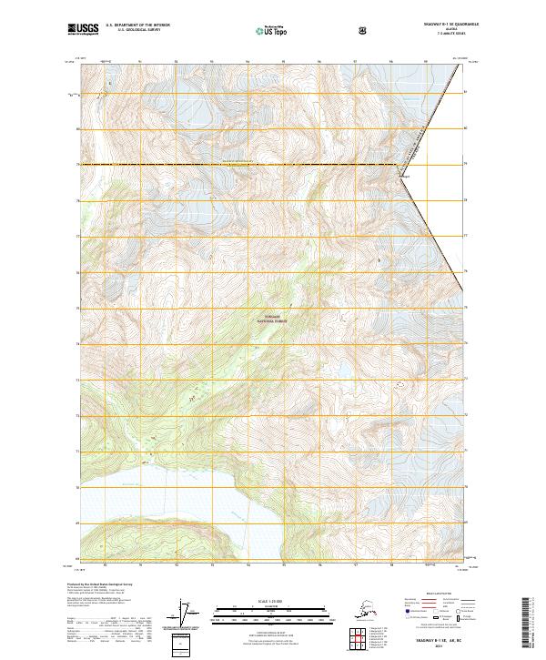
2021 Map of Skagway B-1 SE
USGS Topo · Published 2021About this map
Skagway Municipality Haines Borough marks the administrative heart of this glaciated landscape, where the international boundary between the United States and Canada runs along high mountain crests. The eastern portion of the map is dominated by Mt Bagot and the icy expanse of the Meade Glacier, illustrating the high-altitude drainage systems that feed the valley floors. Much of this territory is preserved within the Tongass National Forest, reflecting a wilderness defined more by topography than human settlement. Along the southern edge, the Katzehin River carves a path through the steep terrain, providing a rare low-lying corridor through the otherwise formidable coastal mountains. This survey serves as a precise record of glacial boundaries and watershed patterns in the early twenty-first century.
Find a feature on this map
10 named features on this map. Tap any name to fly to it.
Don’t see what you’re looking for? This feature index may not catch every label — zoom into the map to look around manually.
Map Details
Editions of this 2021 Skagway B-1 SE Map
This is the sole edition of this map. No revisions or reprints were ever made.
Other maps of this area

1948 · Skagway A-1
USGS Topo · 1:63,360

1949 · Atlin
USGS Topo · 1:250,000

1949 · Skagway B-1
USGS Topo · 1:63,360

1951 · Skagway A-1
USGS Topo · 1:63,360

1951 · Atlin
USGS Topo · 1:250,000

1951 · Skagway B-1
USGS Topo · 1:63,360

1952 · Skagway
USGS Topo · 1:250,000

1960 · Atlin A-8
USGS Topo · 1:63,360
1960 · Atlin B-8
USGS Topo · 1:63,360

1960 · Atlin
USGS Topo · 1:250,000