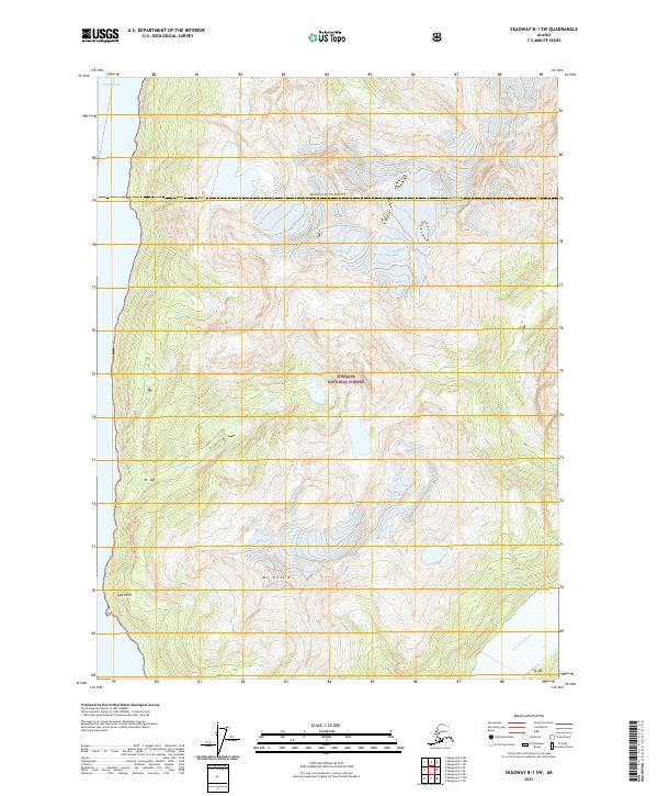
2021 Map of Skagway B-1 SW
USGS Topo · Published 2021About this map
Tongass National Forest dominates this coastal Alaskan landscape, where the boundary between Skagway Municipality and Haines Borough cuts across ice-carved peaks and valleys. The map documents a dramatic vertical environment, centering on the high elevations of Mt Villard and the sprawling expanses of Villard Glacier and Schubee Glacier. These glacial systems feed several waterways that descend toward the coast, including Kasidaya Cr and Dayebas Cr. To the west, the land meets the deep waters of Taiya Inlet at Low Point, while the southeastern corner is defined by the braided path of the Katzehin River. This 2021 survey provides a high-resolution look at the current state of glacial margins and drainage patterns in a region defined by its geological transition from mountain ice to tidal saltwater.
Find a feature on this map
14 named features on this map. Tap any name to fly to it.
Don’t see what you’re looking for? This feature index may not catch every label — zoom into the map to look around manually.
Map Details
Editions of this 2021 Skagway B-1 SW Map
This is the sole edition of this map. No revisions or reprints were ever made.
Other maps of this area

1948 · Skagway A-1
USGS Topo · 1:63,360

1949 · Skagway B-1
USGS Topo · 1:63,360

1951 · Skagway A-1
USGS Topo · 1:63,360

1951 · Skagway B-1
USGS Topo · 1:63,360

1952 · Skagway
USGS Topo · 1:250,000

1954 · Skagway B-2
USGS Topo · 1:63,360

1954 · Skagway A-2
USGS Topo · 1:63,360

1961 · Skagway
USGS Topo · 1:250,000
1991 · Skagway A-1 NW
USGS Topo · 1:25,000
1991 · Skagway B-2 SE
USGS Topo · 1:25,000