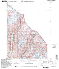
2004 Map of Skagway C-1
USGS Topo · Published 2007About this map
The Chilkoot Trail serves as a central artery through this 2004 revision, tracing the path of the famous 1890s gold rush from Dyea northward toward the international border. This landscape represents the preservation of frontier history within the Klondike Gold Rush National Historical Park, where hikers and historians still encounter relic locations such as Sheep Camp, the Canyon City (Site), and the steep ascent at The Scales (Site). Adjacent to this foot traffic, the White Pass & Yukon Route railroad winds through the mountains near the Klondike Highway, showcasing the evolution of transportation through the high passes.
Find a feature on this map
48 named features on this map. Tap any name to fly to it.
Don’t see what you’re looking for? This feature index may not catch every label — zoom into the map to look around manually.
Map Details
Editions of this 2004 Skagway C-1 Map
This is the sole edition of this map. No revisions or reprints were ever made.
Other maps of this area

1948 · Skagway C-2
USGS Topo · 1:63,360

1948 · Skagway C-1
USGS Topo · 1:63,360

1949 · Atlin
USGS Topo · 1:250,000

1949 · Skagway B-1
USGS Topo · 1:63,360
1949 · Skagway D-2
USGS Topo · 1:63,360

1951 · Skagway C-1
USGS Topo · 1:63,360

1951 · Atlin
USGS Topo · 1:250,000

1951 · Skagway B-1
USGS Topo · 1:63,360

1951 · Skagway C-2
USGS Topo · 1:63,360

1952 · Skagway
USGS Topo · 1:250,000