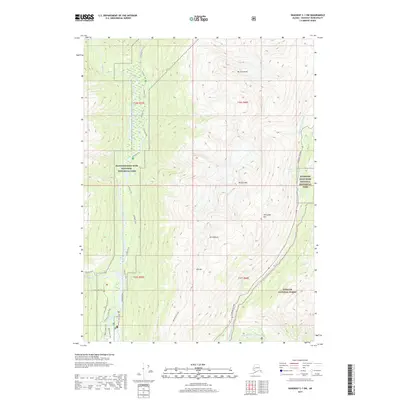
2017 Map of Skagway C-1 SW
USGS Topo · Published 2017About this map
The Chilkoot Trail winds through the heart of the Klondike Gold Rush National Historical Park, tracing the historic route taken by stampeders during the late 19th-century gold rush. This corridor follows the Taiya River northward, flanked by the high peaks of Mt Cleveland and Mt Carmack. To the east, the modern Klondike Highway parallels the Skagway River and its East Fork Skagway River, providing a stark contrast between the traditional footpaths and contemporary transportation infrastructure. The map records several notable landmarks within the Tongass National Forest, including the dramatic Bridal Veil Falls and Pitchfork Falls. In the southwest corner, localized features such as the Slide Cemetery Access Road and the Dyea Flats Access Road point toward the historical settlement sites at the head of the Lynn Canal, where the journey to the interior once began.
Find a feature on this map
30 named features on this map. Tap any name to fly to it.
Don’t see what you’re looking for? This feature index may not catch every label — zoom into the map to look around manually.
Map Details
Editions of this 2017 Skagway C-1 SW Map
This is the sole edition of this map. No revisions or reprints were ever made.
Other maps of this area

1948 · Skagway C-2
USGS Topo · 1:63,360

1948 · Skagway C-1
USGS Topo · 1:63,360

1949 · Skagway B-1
USGS Topo · 1:63,360

1951 · Skagway C-1
USGS Topo · 1:63,360

1951 · Skagway B-1
USGS Topo · 1:63,360

1951 · Skagway C-2
USGS Topo · 1:63,360

1952 · Skagway
USGS Topo · 1:250,000

1954 · Skagway B-2
USGS Topo · 1:63,360

1961 · Skagway
USGS Topo · 1:250,000
1991 · Skagway C-1 SW
USGS Topo · 1:25,000