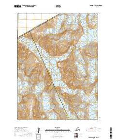
2017 Map of Skagway C-2 NW
USGS Topo · Published 2017About this map
Canada United States of America defines the northern reaches of this high-elevation Alaskan terrain, where the international boundary meets the jurisdictional lines of Skagway Municipality and Haines Borough. The landscape is dominated by extreme verticality, captured in 80-foot contour intervals that detail the steep ascent from the coastal region toward the interior. The interplay between these major administrative boundaries—including the Skagway Municipality Haines Borough line—illustrates the complex political geography of this mountain pass area. While the map is sparse in terms of named structures or settlements, it provides a precise look at the township and range divisions, such as t25s r57e and t25s r58e, which organize this largely undeveloped wilderness near the Canadian border.
Find a feature on this map
9 named features on this map. Tap any name to fly to it.
Don’t see what you’re looking for? This feature index may not catch every label — zoom into the map to look around manually.
Map Details
Editions of this 2017 Skagway C-2 NW Map
This is the sole edition of this map. No revisions or reprints were ever made.
Other maps of this area

1948 · Skagway C-3
USGS Topo · 1:63,360

1948 · Skagway C-2
USGS Topo · 1:63,360
1949 · Skagway D-2
USGS Topo · 1:63,360

1951 · Skagway C-2
USGS Topo · 1:63,360

1952 · Skagway
USGS Topo · 1:250,000
1954 · Skagway C-3
USGS Topo · 1:63,360

1961 · Skagway
USGS Topo · 1:250,000
2017 · Skagway C-2 SW
USGS Topo · 1:25,000
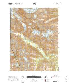
2017 · Skagway C-2 SE
USGS Topo · 1:25,000
2017 · Skagway D-2 SW
USGS Topo · 1:25,000