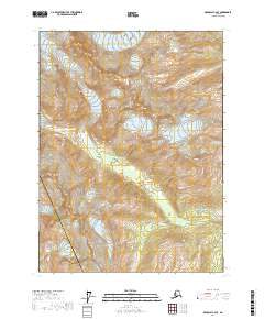
2017 Map of Skagway C-2 SE
USGS Topo · Published 2017About this map
Mt Yeatman dominates the landscape of this high-latitude terrain, where the boundary of the Skagway Municipality Haines Borough cuts through steep glacial valleys. The drainage of West Cr flows through the central portion of the quadrangle, joined further downstream by West Creek as it moves toward the southeast. Evidence of limited human infrastructure is visible in the lower elevations, specifically along W Creek Road, which provides access into the valley from the east. To the southeast, the secluded Lost Lake sits perched above the primary drainage. The map illustrates a transitional wilderness zone where the municipal interests of Skagway and the Haines Borough meet, defined primarily by dramatic topographic relief rather than dense settlement.
Find a feature on this map
10 named features on this map. Tap any name to fly to it.
Don’t see what you’re looking for? This feature index may not catch every label — zoom into the map to look around manually.
Map Details
Editions of this 2017 Skagway C-2 SE Map
This is the sole edition of this map. No revisions or reprints were ever made.
Other maps of this area

1948 · Skagway C-2
USGS Topo · 1:63,360

1948 · Skagway C-1
USGS Topo · 1:63,360

1949 · Skagway B-1
USGS Topo · 1:63,360

1951 · Skagway C-1
USGS Topo · 1:63,360

1951 · Skagway B-1
USGS Topo · 1:63,360

1951 · Skagway C-2
USGS Topo · 1:63,360

1952 · Skagway
USGS Topo · 1:250,000

1954 · Skagway B-2
USGS Topo · 1:63,360

1961 · Skagway
USGS Topo · 1:250,000
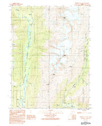
1991 · Skagway C-1 SW
USGS Topo · 1:25,000