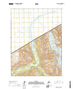
2017 Map of Skagway C-3 NE
USGS Topo · Published 2017About this map
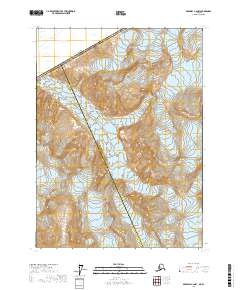
The Chilkat River serves as the central geological artery of this northern landscape, winding through a steep valley that straddles the international boundary between the United States of America and Canada. This 2017 topographic survey of the Skagway C-3 NE quadrangle captures the dramatic elevation of the Haines Borough, where the braided river channels contrast with the high-altitude contours of the surrounding peaks. The mapping of t25s r56e and t26s r57e reflects the formal division of this wilderness, illustrating how the Public Land Survey System imposes order upon a landscape defined by glacial runoff and extreme relief. It is a vital record of the borderlands where the Alaskan panhandle meets British Columbia.
Find a feature on this map
8 named features on this map. Tap any name to fly to it.
Don’t see what you’re looking for? This feature index may not catch every label — zoom into the map to look around manually.
Map Details
Editions of this 2017 Skagway C-3 NE Map
This is the sole edition of this map. No revisions or reprints were ever made.
Other maps of this area

1948 · Skagway C-3
USGS Topo · 1:63,360

1948 · Skagway C-2
USGS Topo · 1:63,360
1949 · Skagway D-2
USGS Topo · 1:63,360

1951 · Skagway C-2
USGS Topo · 1:63,360

1952 · Skagway
USGS Topo · 1:250,000
1954 · Skagway C-3
USGS Topo · 1:63,360

1961 · Skagway
USGS Topo · 1:250,000
2017 · Skagway C-2 SW
USGS Topo · 1:25,000
2017 · Skagway C-2 NW
USGS Topo · 1:25,000
2017 · Skagway D-2 SW
USGS Topo · 1:25,000