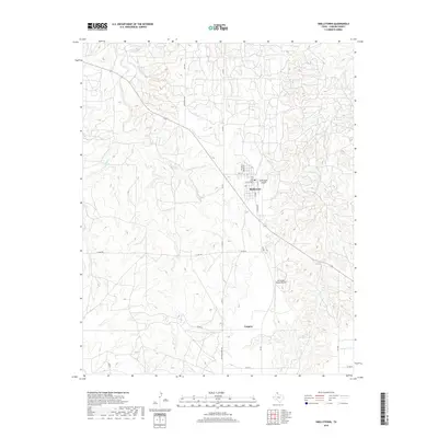
2019 Map of Skellytown
USGS Topo · Published 2019About this map
Skellytown serves as the primary hub of this Carson County landscape, where the street grid of Main St and Roosevelt St meets the open range of the Texas Panhandle. The map reveals a transition from the town center to the surrounding ranchlands, characterized by a series of drainage systems including Spring Cr and the winding White Deer Cr. Aviation is a notable component of the local infrastructure, with both the Skellytown Airport and the Arrington Ranch Airport situated near the settlement of Cargray. The road network, including the historic path of Old White Deer Rd and E Camp Rd, suggests a landscape shaped by ranching and resource management. This survey provides a clear view of the rural development patterns in the region, where isolated outposts and small airstrips punctuate the expansive drainage basins of the southern High Plains.
Find a feature on this map
23 named features on this map. Tap any name to fly to it.
Don’t see what you’re looking for? This feature index may not catch every label — zoom into the map to look around manually.
Map Details
Editions of this 2019 Skellytown Map
This is the sole edition of this map. No revisions or reprints were ever made.
Other maps of this area

1953 · Borger SE
USGS Topo · 1:24,000

1953 · Phillips
USGS Topo · 1:24,000

1954 · Amarillo
USGS Topo · 1:250,000

1958 · Amarillo
USGS Topo · 1:250,000

1963 · Skellytown
USGS Topo · 1:24,000

1965 · White Deer
USGS Topo · 1:24,000

1965 · Lake Mc Connell
USGS Topo · 1:24,000

1966 · Cuyler
USGS Topo · 1:24,000

1966 · Kingsmill
USGS Topo · 1:24,000

1970 · Phillips
USGS Topo · 1:24,000