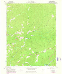
1967 Map of Skelt
USGS Topo · Published 1982About this map
Skelt and Woodzell serve as the primary focal points for this portion of the West Virginia highlands, where the Back Fork Elk River and the main Elk River carve deep drainages through the steep landscape. The map reveals a community structured around the heights of Point Mountain and the water-level tracks along the riverbanks. Early educational and spiritual life is evident through landmarks like Jumbo Sch, McCoy Ch, and the high-elevation Point Mountain Ch.
Find a feature on this map
58 named features on this map. Tap any name to fly to it.
Don’t see what you’re looking for? This feature index may not catch every label — zoom into the map to look around manually.
Map Details
Editions of this 1967 Skelt Map
2 editions found
Other maps of this area

1891 · Huntersville
USGS Topo · 1:125,000

1893 · Buckhannon
USGS Topo · 1:125,000

1894 · Huntersville
USGS Topo · 1:125,000

1896 · Buckhannon
USGS Topo · 1:125,000

1897 · Buckhannon
USGS Topo · 1:125,000

1913 · Hacker Valley
USGS Topo · 1:48,000

1913 · Pickens
USGS Topo · 1:48,000

1915 · Webster Springs
USGS Topo · 1:48,000

1915 · Hacker Valley
USGS Topo · 1:62,500

1915 · Pickens
USGS Topo · 1:62,500