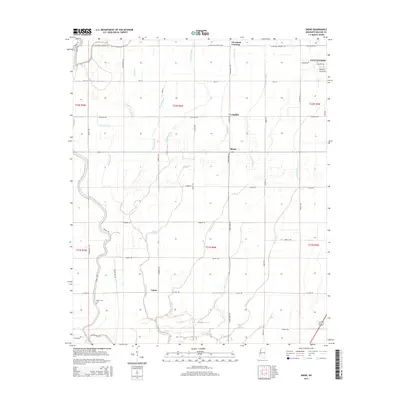
2015 Map of Skene
USGS Topo · Published 2015About this map
The agricultural landscape of Bolivar County, Mississippi, is defined by an intricate network of drainage bayous and sloughs centered around the settlement of Skene. This area of the Delta showcases a pattern of roads that often follow the meandering paths of waterways like Bogue Phalia and Icy Bayou, or adhere to the strict section lines of the Public Land Survey System. The presence of Litton and Laughlin illustrates the dispersed nature of local centers in this region, while the Mount Zion Cem serves as a vital landmark for genealogical research. A notable detail is Dummy Line Rd, a name that frequently indicates the route of a former logging or plantation railroad, reflecting the historic timber and cotton economy that shaped the local geography before modern consolidation.
Find a feature on this map
44 named features on this map. Tap any name to fly to it.
Don’t see what you’re looking for? This feature index may not catch every label — zoom into the map to look around manually.
Map Details
Editions of this 2015 Skene Map
This is the sole edition of this map. No revisions or reprints were ever made.
Other maps of this area

1931 · Drew
USGS Topo · 1:48,000

1934 · Cleveland
USGS Topo · 1:62,500

1935 · Mound Bayou
USGS Topo · 1:62,500

1939 · Pace
USGS Topo · 1:62,500

1939 · Choctaw
USGS Topo · 1:62,500

1940 · Cleveland
USGS Topo · 1:62,500

1953 · Greenwood
USGS Topo · 1:250,000

1956 · Greenwood
USGS Topo · 1:250,000
1966 · Merigold
USGS Topo · 1:24,000

1966 · Cleveland
USGS Topo · 1:24,000