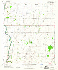
1967 Map of Skene
USGS Topo · Published 1968About this map
Bogue Phalia and its winding tributaries dominate this Bolivar County landscape, where the 1960s agricultural character is defined by an intricate network of bayous and irrigation canals. The drainage system, including West Bogue Hasty, Icy Bayou, and the Bear Pen Canal, reflects the intensive land management required for Delta farming. Small rural communities and intersections like Skene, Litton, and Laughlin serve as local anchors, connected by the Illinois Central railroad line.
Find a feature on this map
30 named features on this map. Tap any name to fly to it.
Don’t see what you’re looking for? This feature index may not catch every label — zoom into the map to look around manually.
Map Details
Editions of this 1967 Skene Map
This is the sole edition of this map. No revisions or reprints were ever made.
Other maps of this area

1931 · Drew
USGS Topo · 1:48,000

1934 · Cleveland
USGS Topo · 1:62,500

1935 · Mound Bayou
USGS Topo · 1:62,500

1939 · Pace
USGS Topo · 1:62,500

1939 · Choctaw
USGS Topo · 1:62,500

1940 · Cleveland
USGS Topo · 1:62,500

1953 · Greenwood
USGS Topo · 1:250,000

1956 · Greenwood
USGS Topo · 1:250,000
1966 · Merigold
USGS Topo · 1:24,000

1966 · Cleveland
USGS Topo · 1:24,000