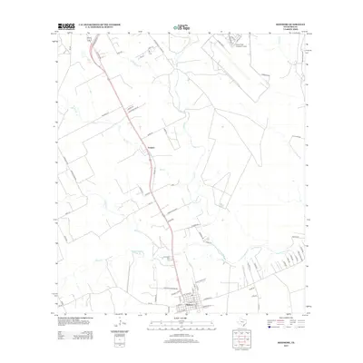
2013 Map of Skidmore
USGS Topo · Published 2013About this map
Skidmore and the surrounding South Texas coastal plains are defined by a network of drainage systems feeding toward the coast. The town itself serves as a local hub where several major county roads and highways converge, reflecting a rural landscape that balances agricultural activity with aviation infrastructure. To the northeast, the Chase Field Industrial Airport occupies a significant footprint, utilizing the open terrain of the region.
Find a feature on this map
74 named features on this map. Tap any name to fly to it.
Don’t see what you’re looking for? This feature index may not catch every label — zoom into the map to look around manually.
Map Details
Editions of this 2013 Skidmore Map
This is the sole edition of this map. No revisions or reprints were ever made.
Other maps of this area

1927 · Mathis
USGS Topo · 1:62,500

1953 · Beeville
USGS Topo · 1:250,000

1954 · Skidmore
USGS Topo · 1:62,500

1954 · Fleming
USGS Topo · 1:62,500

1954 · Mathis
USGS Topo · 1:62,500

1954 · Sinton
USGS Topo · 1:62,500

1956 · Beeville
USGS Topo · 1:250,000

1960 · Beeville
USGS Topo · 1:250,000

1979 · Burkes Ridge
USGS Topo · 1:24,000
1979 · Tynan
USGS Topo · 1:24,000