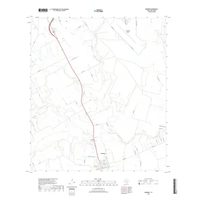
2019 Map of Skidmore
USGS Topo · Published 2019About this map
The settlement of Skidmore serves as the focal point of this Bee County landscape, situated where the Aransas River meets a network of local drainages. The town's grid is centered on W Main St and E Main St, with the long-established Evergreen Cem located just to the north along Old Hwy 181. The surrounding area is characterized by the meandering paths of Aransas Cr, Olmos Cr, and Poesta Cr, which define the local topography.
Find a feature on this map
52 named features on this map. Tap any name to fly to it.
Don’t see what you’re looking for? This feature index may not catch every label — zoom into the map to look around manually.
Map Details
Editions of this 2019 Skidmore Map
This is the sole edition of this map. No revisions or reprints were ever made.
Other maps of this area

1927 · Mathis
USGS Topo · 1:62,500

1953 · Beeville
USGS Topo · 1:250,000

1954 · Skidmore
USGS Topo · 1:62,500

1954 · Fleming
USGS Topo · 1:62,500

1954 · Mathis
USGS Topo · 1:62,500

1954 · Sinton
USGS Topo · 1:62,500

1956 · Beeville
USGS Topo · 1:250,000

1960 · Beeville
USGS Topo · 1:250,000

1979 · Burkes Ridge
USGS Topo · 1:24,000
1979 · Tynan
USGS Topo · 1:24,000