2022 Map of Skidmore
USGS Topo · Published 2022About this map
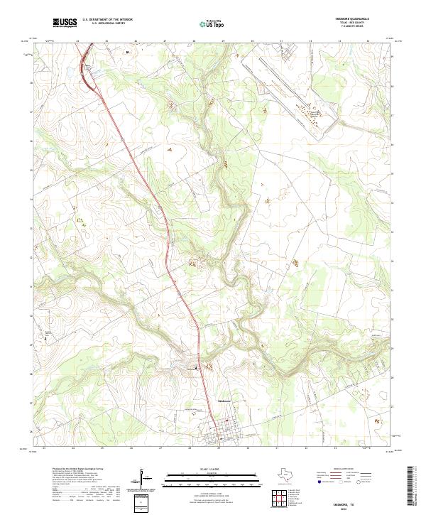
The settlement of Skidmore serves as the focal point for this South Texas landscape, situated at the confluence of several seasonal waterways. The drainage patterns of the Aransas River and its numerous tributaries, such as Poesta Cr and Olmos Cr, define the topography of the region. Local history is anchored by the Evergreen Cem and Central District Cem, which reflect the community's long-standing roots. To the northeast, the Chase Field Industrial Airport marks a transition from agricultural land to aviation and industrial use, flanked by Perimeter Rd. This area is characterized by a network of rural roads like Old St Marys Rd and Lonesome Oak Dr, connecting family-owned tracts and ranches through the coastal plains north of the Aransas River.
Find a feature on this map
49 named features on this map. Tap any name to fly to it.
Don’t see what you’re looking for? This feature index may not catch every label — zoom into the map to look around manually.
Map Details
Editions of this 2022 Skidmore Map
This is the sole edition of this map. No revisions or reprints were ever made.