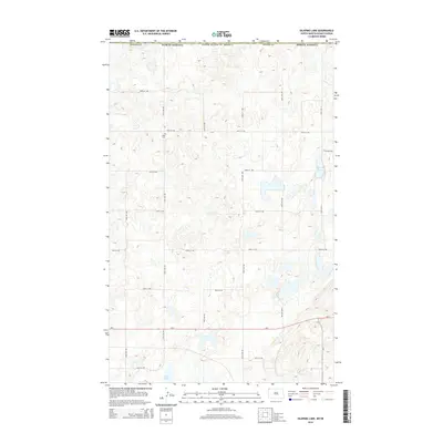
2014 Map of Skjermo Lake
USGS Topo · Published 2014About this map
Olso Cem serves as a small, significant marker of local heritage within this section of Divide County, north of the ND-5 corridor. This portion of the North Dakota prairie is characterized by a high density of small water bodies and glacial depressions, including Skjermo Lake and North Lake. The landscape is organized by a precise grid of rural roads such as 107th St NW and 151st Ave NW, reflecting the late-era persistence of the township-and-range system. While largely open land, the presence of the cemetery alongside these section-line roads provides a vital touchstone for genealogists and researchers tracing the families who settled this corner of the state near the international border.
Find a feature on this map
22 named features on this map. Tap any name to fly to it.
Don’t see what you’re looking for? This feature index may not catch every label — zoom into the map to look around manually.
Map Details
Editions of this 2014 Skjermo Lake Map
This is the sole edition of this map. No revisions or reprints were ever made.
Other maps of this area

1953 · Williston
USGS Topo · 1:250,000

1954 · Wolf Point
USGS Topo · 1:250,000

1957 · Williston
USGS Topo · 1:250,000

1958 · Wolf Point
USGS Topo · 1:250,000

1983 · Westby South
USGS Topo · 1:24,000

1983 · Writing Rock North
USGS Topo · 1:24,000

1983 · Alkabo
USGS Topo · 1:24,000

1983 · Westby North
USGS Topo · 1:24,000
1983 · Fortuna
USGS Topo · 1:24,000
1983 · Skjermo Lake
USGS Topo · 1:24,000